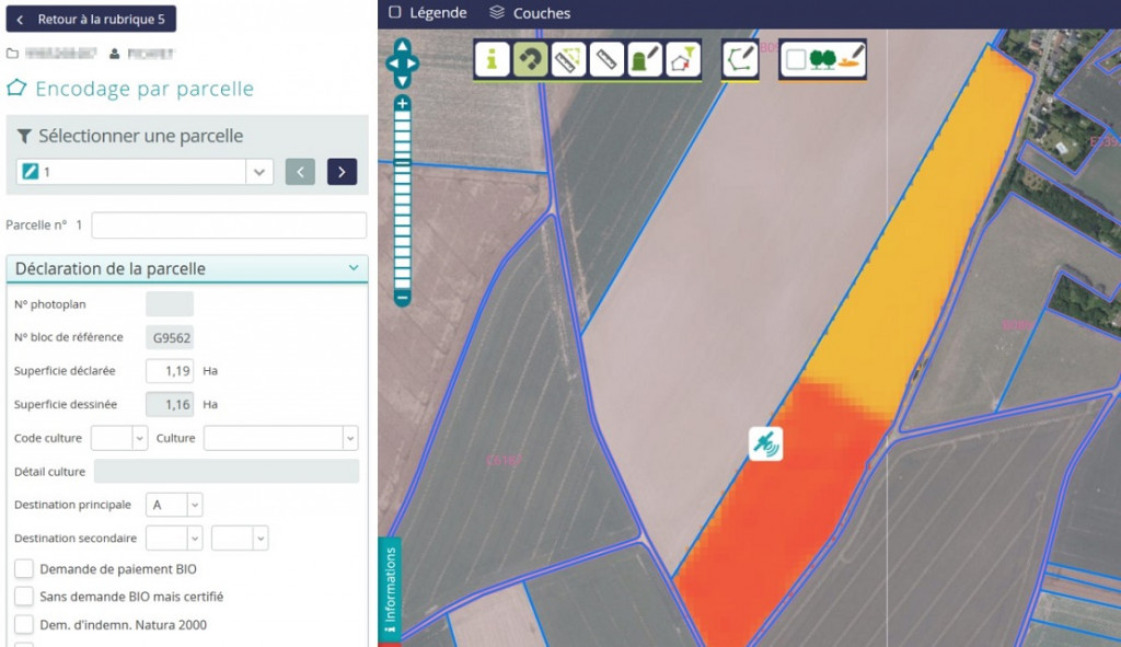
The results obtained enable visualisation of plots whose last declared boundaries do not/no longer correspond to the reality on the ground. This provides farmers with very recent images of plots that have changed compared with the previous year. They are then in a better position to target the plots and delineate them t when they apply for their aids (directly on PAConWEB).
This research has also led to the detection of bare soils, mowing and even the destruction of cover, using the temporal evolution of indices derived from SENTINEL images. The results obtained can be used as markers of agricultural activity in order to determine the eligibility for subsidies and process the payment of farmers.
They also enable the detection of new urban features on agricultural plots. The objective is to facilitate the update and to improve the quality of the agricultural plots delineation. The method is based on the evolution over time of a vegetation index derived from SENTINEL images. This index falls when the vegetation is replaced by an urban feature.
The CRA-W is developing protocols and algorithms to monitor the evolution of Walloon agriculture using satellite images. These methods provide objective information to the Walloon authorities with a view to reduce the administrative burden associated with the payment of subsidies from the Common Agricultural Policy (CAP).
Funding: Project subsidised by the SPW, grant No. D65-1410.