

Attaché scientifique
Dimitri GOFFART

Les articles de Dimitri GOFFART
Scientific publications

 CRA-W
CRA-W
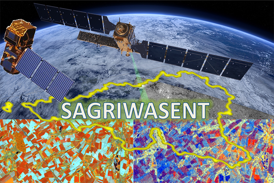
SAGRIWASENT : Développement de prototypes fonctionnels pour le SPW
Beriaux, E. , Goffart, D. , Jago, A. , Lucau-Danila, C. & Planchon, V. (2021). SAGRIWASENT : Développement de prototypes fonctionnels pour le SPW. Proceedings in: GTEO, Online,...
News


Satellites to assess the nitrogen status of potatoes
Sentinel-2 satellite and temperature data allow a good assessment of the nitrogen status of the potato crop at the plot scale.
Scientific publications
CRA-W
UAV borne spectrometers for high-resolution soil and crop monitoring. Virtual Border-crossing Earth Observation Day 2020 (BEODAY).
Van Wesemael, B. , Goffart, D. , Dvorakova, K. , Zhang, H. , Crucil, G. , Van Oost, K. , Castaldi, F. , Planchon, V. , Curnel, Y. , Goffart, J.-. , Le Clef, A. , Limbourg, Q. &...
Scientific publications
Field-scale assessment of Belgian winter cover crops biomass based on Sentinel-2 data. (BELCAM)
Goffart, D. , Curnel, Y. , Planchon, V. , Goffart, J.P. & Defourny, P. (2021). Field-scale assessment of Belgian winter cover crops biomass based on Sentinel-2 data. (BELCAM)....
Scientific publications

Monitoring et pilotage de la culture de pomme de terre à l’aide de données issues de capteurs optiques au champ et embarqués sur drones et de satellites : Recherches réalisées en Belgique et potentialités d’application dans la pratique.
Ben Abdallah, F. , Goffart, D. & Limbourg, Q. (2020). Monitoring et pilotage de la culture de pomme de terre à l’aide de données issues de capteurs optiques au champ et embarqués...
Scientific publications
UAV Remote Sensing for Detecting within-Field Spatial Variation of Winter Wheat Growth and Links to Soil Properties and Historical Management Practices. A Case Study on Belgian Loamy Soil
Goffart, D. , Dvorakova, K. , Curnel, Y. , Crucil, G. , Limbourg, Q. , Planchon, V. , Van Oost, K. , Van Wesemael, B. & Goffart, J.-. (2022). UAV Remote Sensing for Detecting within-Field...
Scientific publications
UAVSoil Final Steering Committee
Van Wesemael, B. , Goffart, D. , Dvorakova, K. , Zhang, H. , Crucil, G. , Van Oost, K. , Castaldi, F. , Planchon, V. , Curnel, Y. , Goffart, J.P. , Limbourg, Q. , Le Clef, A. &...
Scientific publications
CRA-W
5ème Comité Scientifique
Beriaux, E. , Goffart, D. , Jago, A. , Lucau-Danila, C. , Mulot, E. , Planchon, V. & Poismans, R. (2020). 5ème Comité Scientifique. Gembloux - Belgium, 29/09/2020.
38
rows