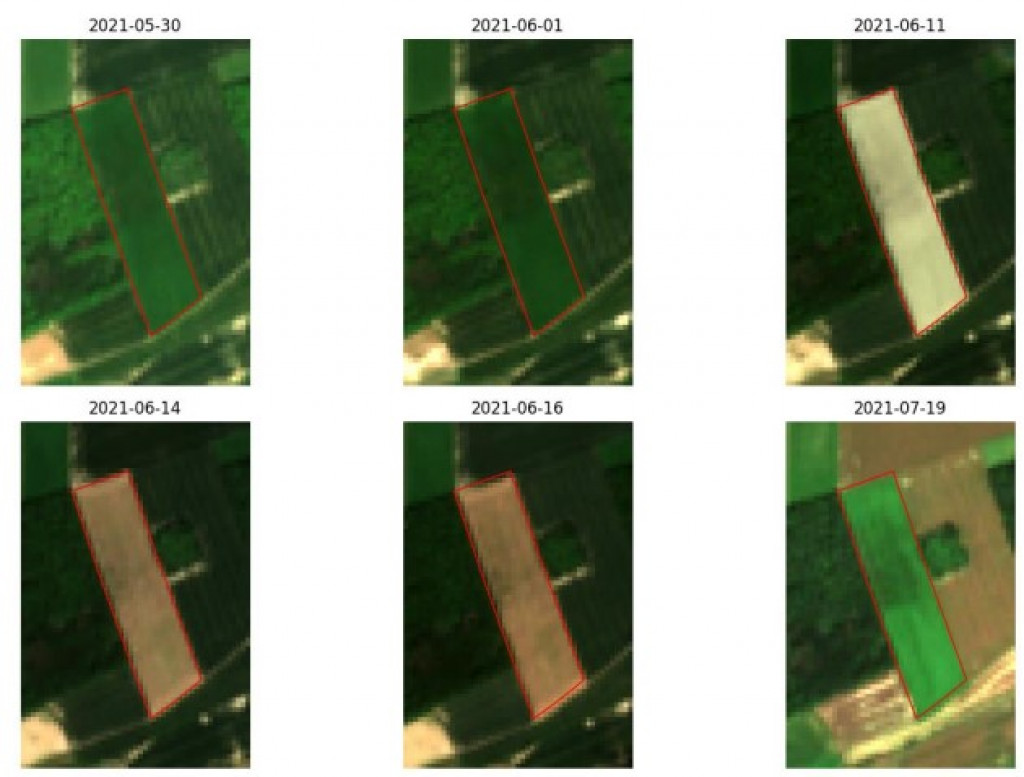
Analysing Sentinel images over time, in the form of time series, enables to visualise the evolution of agricultural parcels over a defined period. Certain images showing a change in parcel boundaries can be made available to farmers.

Time series of Sentinel satellite images for a parcel whose boundaries have changed over time.
The SAGRIWASENT II project has developed various algorithms to detect crop types, bare soil, crop destruction and mowing (mowed grassland visible on the image of 11 June 2021 below) using the temporal evolution of indices derived from SENTINEL images.
The high-quality protocols and algorithms developed by CRA-W to monitor the evolution of Walloon agriculture using satellite images are used by the Walloon authorities. Once implemented in the Walloon Paying Agency systems, these tools provide objective information on agricultural activities, thus aiming to reduce the administrative burden linked to the payment of Common Agricultural Policy (CAP) subsidies.
Financing
Project subsidised by SPW, grant no. D65-1410.
Legend : Sentinel 2 images acquired from 30 May 2021 to 19 July 2021 showing a parcel of grassland. The images show that mowing was carried out at the beginning of June.